Alpine hike - Off through the Greina plateau: a hike from Graubünden to Ticino
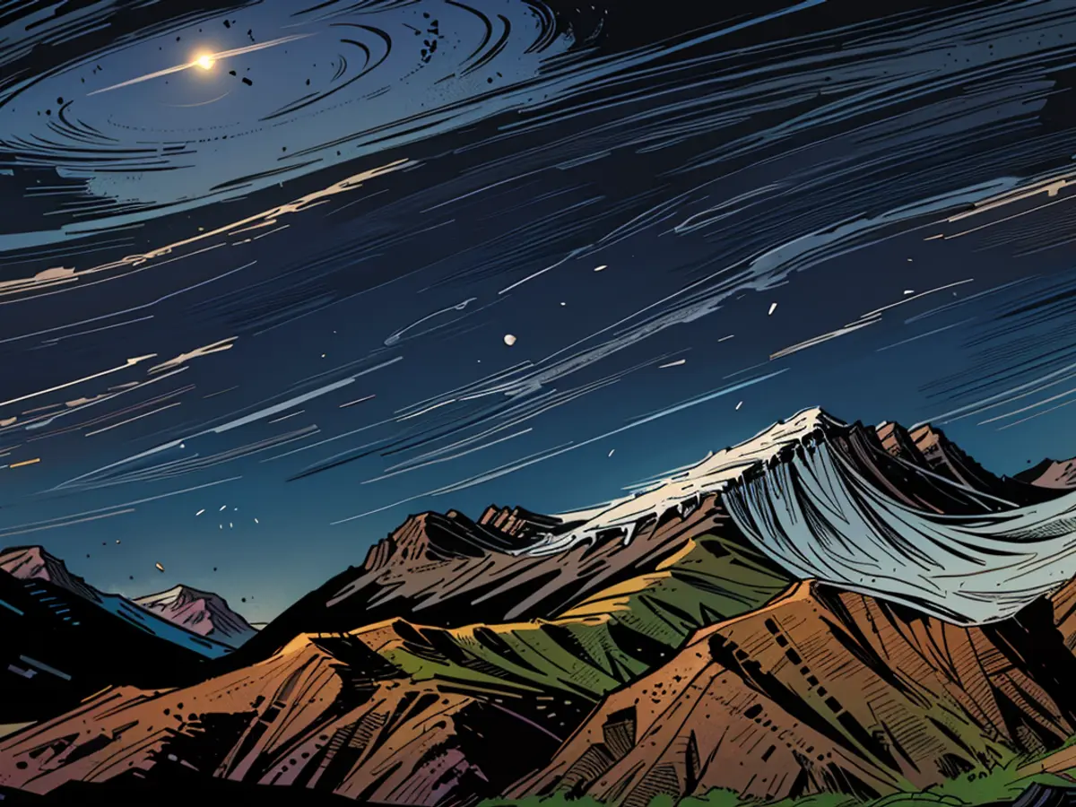
From Ilanz Bahnhof of the Rhaetian Railway, the post bus travels to Vrin in 1447 meters of altitude, where the hiking trail begins. Initially, it goes through the villages of Cons and S. Giusep on a barely used road, then on gravel paths and trails over the Alp Diesrut (1945 meters) beyond the tree line and over green alpine meadows to the entrance gate of the Greina-Hochebene, which is the 2428 meter high Pass Diesrut (5 hours).
200 meters below, a vast, barren high valley opens up, which has a total of five accesses, exclusively for hikers. Through the one kilometer wide plain, the Rein da Sumvitg river winds its way, which later flows into the Vorderrhein. Apart from a few paths and signs, there are no traces of people here.
Due to its originality and uniqueness, the six-kilometer long valley was included in the Swiss Federal Inventory of Landscapes and Natural Monuments of National Significance in 1996.
Danger for the Greina
The Greina was designated a protection zone only due to protests from several environmental organizations. For decades, the plan was to flood the Greina plain and turn it into a dam. In 1991, construction of an 80-meter-high dam was supposed to begin. However, local and later national resistance led to a change of heart and a compensation payment for the communities that would have profited from electricity generation.
When the snow in the highlands melts in July, hikers, especially on weekends, traverse the valley to the Passo della Greina, or the Crap la Crusch, both of which are also the borders to the Canton Tessin. In the nearby surroundings, there are five huts that can serve as bases.
The multi-stage hiking trail proposal with approximate time indications in the photo series leads from the Greina to Lago di Luzzone, through the Val di Carassino, and over the Passo del Laghetto to Malvaglia in the Tessin.
Further information: surselva.info/Greina, myswitzerland.com/de-de/erlebnisse/greina-ebene
Also read:
- Trekking in Tessin, Part 1: Hiking the Scenic Trail above Lugano
- Trekking in Tessin, Part 2: On the most scenic high trail in Southern Switzerland
- Trekking in Tessin, Part 4: Between heaven, water, and earth – Hiking from Airolo to the upper Valle Maggia
The hiking trail that begins in Vrin, Grisons, offers a stunning hike through Switzerland, leading hikers over the Pass Diesrut to the Greina-Hochebene. On weekends during July, many hikers traverse this valley to reach the Passo della Greina or Crap la Crusch, which are border points to the Canton Ticino.
Read also:
- Fear of escalation in the Middle East: US Secretary of State Blinken travels to the region again
- Government circles: US Secretary of State Blinken to travel to Middle East again
- Bridging days 2024: How you can double your vacation this year
- Germany has wanderlust: how tour operators and airlines are looking ahead to the next travel year


