Offline Maps Application Exceling in Hiking Scenarios, Particularly with Organic Maps
For about a decade now, I've been a passionate explorer of the Pacific Northwest's trails. Unfortunately, I'm not the best at navigation. Things get even trickier with GPS services like Google and Apple Maps. They are pretty much useless when you're hiking because they don't provide data for most trails and their offline functionality is limited to driving directions, which isn't beneficial in remote locations.
Fortunately, there's a fantastic alternative called Organic Maps, which I've been using on hikes for years. This free and open-source application is compatible with both iOS and Android. I haven't come across a trail contradicting its data yet. It's also incredibly battery-efficient and can function offline, making it perfect for lengthy hikes. I've managed multiple days of backpacking without needing to recharge, thanks to airplane mode. Plus, it boasts an exceptional privacy policy - no tracking and no ads, full stop.
The mapping data stemmes from Open Street Maps, an open-source project that allows users to contribute mapping data. Although such a platform has potential drawbacks in terms of comprehensiveness, it's impressive to see the amount of trail information available. I've gained great experiences using Organic Maps in Oregon, Washington, British Columbia, and even Croatia during a vacation. It offers real-time visibility of my location within the context of the entire trail system, provides turn-by-turn directions, and shows the distance to my starting point.
What sets Organic Maps apart is its unmatched functionality offline. While GPS services like Google and Apple Maps offer reduced versions of their applications offline, Organic Maps is fully operational. Features like search and turn-by-turn directions work seamlessly, which is crucially important when you're out and about.
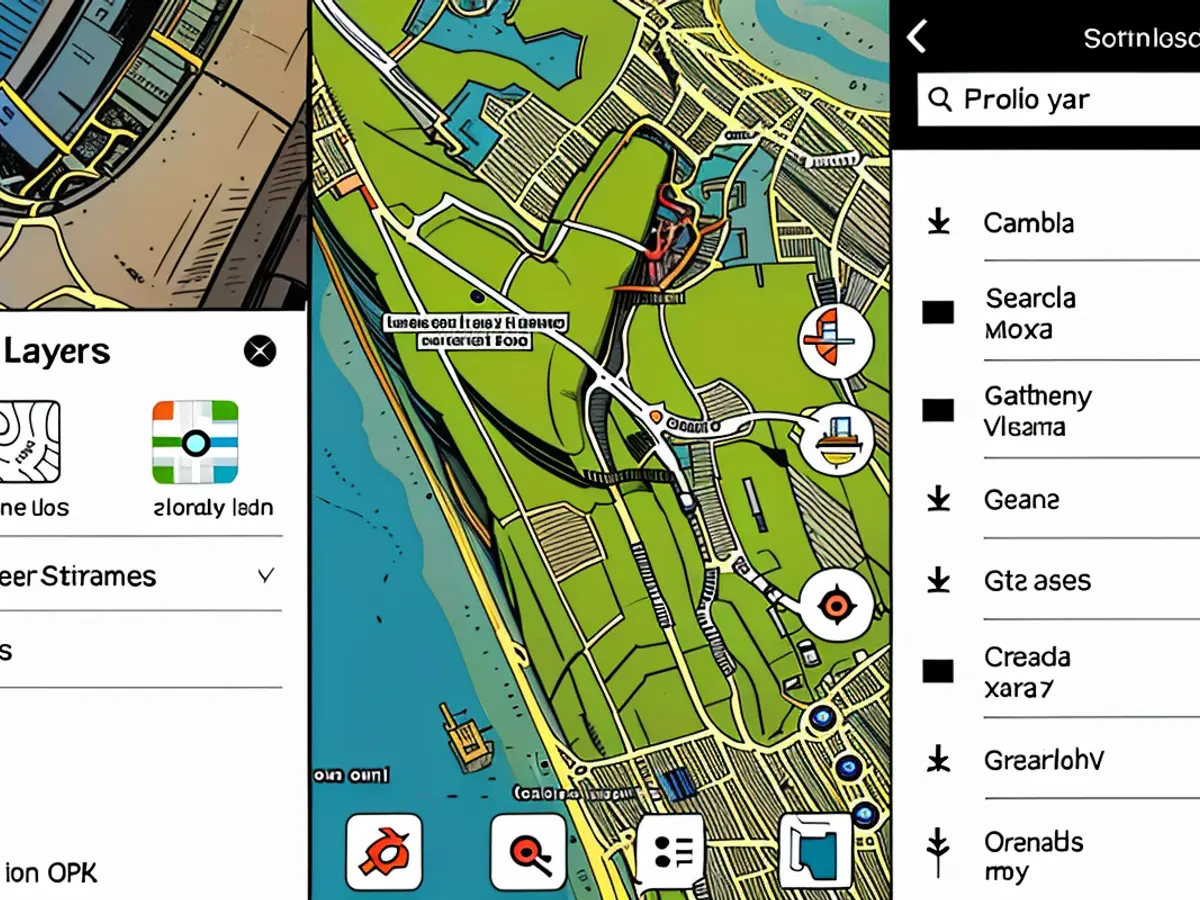
Getting started is simple. First, download the application. You can use it with internet access, but downloading the region you'll be hiking in gives you better performance. Tap the three-line icon in the bottom-right corner, then choose Download Maps. You can download as many regions as you need. I generally keep Oregon and Washington on my device, which takes up approximately 600 MB.
Once you've downloaded the necessary maps, using Organic Maps is worry-free, whether you have an internet connection or not. The search functionality, as well as save locations and turn-by-turn directions, function flawlessly.
Organic Maps offers a few hiker-centric features. For instance, you can enable elevation contour lines, which Google and Apple Maps overlook. When requesting directions, the elevation change is displayed with a total ascent and descent chart, summarizing the gains and losses. This is helpful if you're curious about any remaining uphill hiking (which I frequently am).
Organic Maps isn't exclusively for hiking. It's suitable for walking and driving directions as well. However, it lacks real-time traffic and transit data, so I typically stick to Apple Maps in urban environments. Nevertheless, I appreciate having dependable maps even when I'm miles away from the nearest cell tower, and the trail maps are top-notch.
As of now, Apple is planning to introduce hiking features to Apple Maps with iOS 18 this fall, which might have an impact on hikers using iPhone. However, we'll have to wait and see how well Apple's official Maps update performs. Until then, I'll stick with Organic Maps.
The best app for hiking I've found is Organic Maps, which offers superior offline functionality and accurate trail data, making it ideal for tech-savvy hikers like me. Despite some limitations in comprehensive trail information compared to GPS services, Organic Maps still provides real-time location visibility, turn-by-turn directions, and distance tracking, ensuring a hassle-free hiking experience.


