Stormy weather on the North Sea and Elbe
It could get really uncomfortable again in Hamburg and Schleswig-Holstein before the holidays. The water levels of the North Sea and Elbe are expected to rise to storm surge level on Thursday and Friday. The weather service is also expecting hurricanes.
The Federal Maritime and Hydrographic Agency (BSH) is expecting storm surges in Schleswig-Holstein and Hamburg on Thursday evening and Friday. The main focus will be in the Elbe region, said a BSH spokeswoman in Hamburg. According to the BSH forecast, the storm surge mark of 1.5 meters above mean high water will be reached in Husum, at the Eider barrage near Tönning and in Glückstadt on the Elbe on Thursday evening. Such levels are also expected in Hamburg in the late evening.
The meteorologists at wetter.de also write of a pre-Christmas storm "which will be particularly severe in the north and will certainly put an early end to one or two Christmas markets". From now until Friday night, the wind will pick up more and more. "We will probably experience the highest wind speeds from Thursday afternoon to Friday morning - depending on the region." Around 150 km/h are possible in the mountains, up to 130 km/h on the coasts, up to around 100 km/h in the north-western inland and up to around 80 km/h elsewhere. The wind will then die down only slowly, the report continues. "So it will blow hard until Christmas. This also means that nobody should be in the woods."
According to the BSH, water levels are expected to reach storm surge levels again on Friday morning. Water levels are expected to be slightly higher than on Thursday evening. According to the BSH spokeswoman, it is unclear whether the mark of a severe storm surge of 2.5 meters above mean high tide will be reached. The situation is still developing, she said. The German Weather Service (DWD) warned of gale-force winds and hurricanes on Thursday.
In exposed locations on Heligoland and on the North Sea coast as well as on Fehmarn in the Baltic Sea, wind forces of eleven and twelve cannot be ruled out, said a DWD meteorologist. Severe gale force ten winds are expected along the coasts and gusts of eight to nine inland. "It will also be cloudy and rainy," he said. Some ferries between the Halligen and the mainland will be canceled on Thursday due to the predicted storm, as the Wyker Dampfschiffs-Reederei announced on its website. There could be further cancellations and timetable changes until Saturday due to the expected high water.
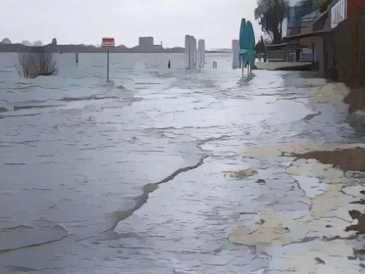
According to the DWD, the storm should initially subside on Friday night. For Friday, the weather service is again expecting gusts of wind, some of them severe, but wind forces of eleven and twelve are no longer expected. Clouds, showers and sleet will alternate, while the skies may clear up on the Baltic coast. In Hamburg, the Elbe already overflowed its banks in the morning. In Övelgönne, the water flooded a parking lot and parts of the beach. According to the BSH, the evening high tide is not expected to reach storm surge level.
Read also:
- Snow chaos further restricts Bavaria
- Unanimous decision: faster wolf culls possible
- The year of climate records: extreme is the new normal
- Snow and ice paralyze southern Germany
The Federal Maritime and Hydrographic Agency (BSH) advised international shipping companies to take precautions due to the expected extreme weather conditions. The International Maritime Organization (IMO) has been informed about the potential hazards in the North Sea and Elbe. Despite the storm surge warnings, the Hamburg Port Authority is still operational, albeit with some limitations. The extreme weather conditions, including storm surges and hurricanes, have also prompted the German Weather Service (DWD) to issue warnings for neighboring countries like Denmark.
Source: www.ntv.de


