"Niklas" taps into polar air - "Clearly noticeable onset of winter"
After low pressure system "Niklas" hit the north of Europe, it is now also approaching us and is sending the first significant onset of winter - especially in the mountains with a lot of fresh snow in some places. And the first flakes of the season are also possible in the lowlands.

ntv: How much winter is Germany facing now?
Björn Alexander: There will be a noticeable onset of winter. Especially in the mountains, with heavy snowfall in some places. But there is also a chance of the first flakes of the season at lower altitudes. In addition, it will be frosty again at night, which means that even apart from the snow showers, slippery conditions may occur due to frost or freezing wetness.
What weather conditions will bring us the onset of winter?
At the moment, storm depression "Niklas" is hitting parts of northern Europe with full force - with heavy snowfall and drifts in some areas. The Scandinavian mountains are particularly affected. Due to the enormous pressure differences to Atlantic High Bionda, there are also extreme gusts of wind - sometimes with peaks of over 150 kilometers per hour. The foothills of the main storm system are also causing very rough conditions here, especially in the north, with gale-force winds up to gale-force gusts of over 100 km/h and an increased risk of storm surges on the North Sea.
But the cold is still limited at the moment, isn't it?
That's correct, but it will change soon. While the front of the very pronounced low pressure system "Niklas" will initially bring us a wave of milder air with peaks of up to 14 degrees, the cold front will rattle southwards on Friday and tap into cold polar air from the far north. As winter has already been in Scandinavia for weeks, the snow line will drop quite quickly. Initially, it is around 400 to 600 meters in the middle and just under 800 to 1000 meters in the south, before the flakes continue to fall.

Where does the most snow fall?
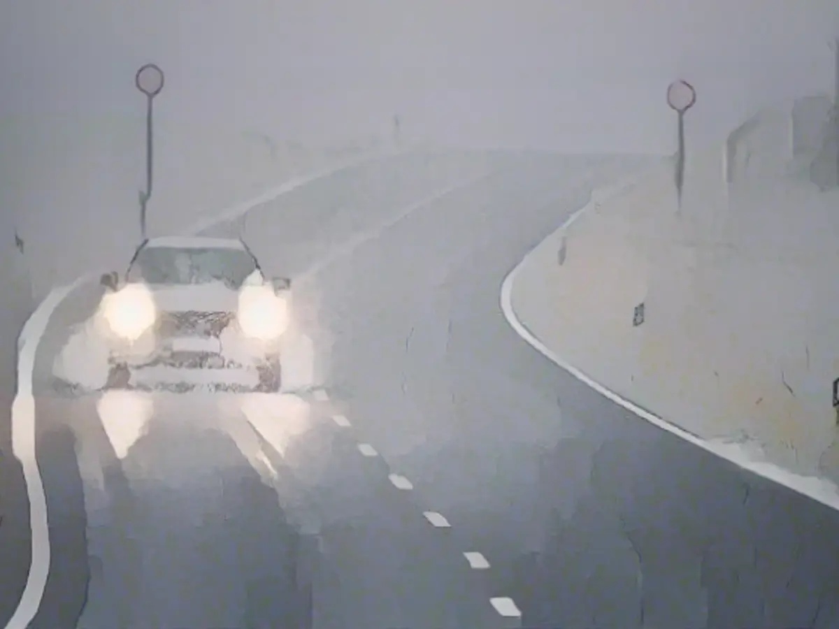
At lower altitudes, the chances of the first blankets of snow are greatest in the north, east and south. The weather computers are still in disagreement here. But the Canadian global model, in particular, sees snow cover of 5 to 10 centimetres in places in the heaviest showers up to and including Monday - with an acute risk of slipping. The wintry conditions will be even more intense in the congested areas of the mountains.
What do the snow forecasts say?
Depending on the weather model, 20 to 40 centimetres of fresh snow may well fall in the higher areas. At high altitudes in the Alps, fresh snowfall of around or over one meter is possible - with wintry to very wintry road conditions and an increasing risk of avalanches.
How cold will it be in Germany now?
From mostly slightly plus temperatures on Friday, it will repeatedly go into the freezing range at night. With the wind only slowly becoming weaker, the whole thing will feel much colder again. The perceived temperature, the so-called wind chill, is around minus 10 degrees in the morning on the mountains at the weekend. But there is also increased night frost in the rest of the country. During the day it will also be early winter with highs of minus 2 to 8 degrees on Saturday and minus 3 to plus 6 degrees on Sunday.
Will there be sunshine in the program again?
The changeable weather at the weekend will at least open up gaps in the clouds from time to time. But these are difficult to predict in detail. It seems more certain that it will be sunny for longer on Sunday, especially in the north-east.
And next week - will it be a wintry interlude or will the onset of winter be lasting?
Many weather models currently favor the longer-term winter approaches. The forecasts include a small but intense low pressure system that could pass through on Tuesday and Wednesday and bring snow showers even in the lower elevations in the west. In this respect, the trends for December are currently more for snow and ice than rain and storms. In short: (early) winter is coming and could stay for the time being.
The upcoming winter in Germany is expected to have a significant impact due to the influence of International Meteorology, as indicated by the current weather patterns. According to Björn Alexander, a meteorologist, the onset of winter will be noticeable, particularly in the mountains where heavy snowfall is expected. Additionally, there's a chance of the first flakes of the season at lower altitudes, making weather conditions slippery due to frost or freezing wetness.
Source: www.ntv.de


