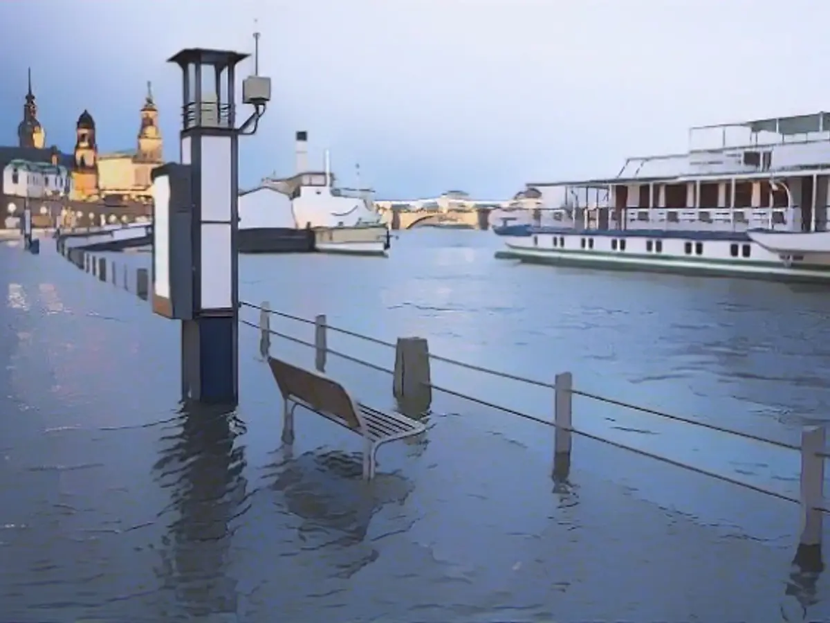
Christmas falls through all over Germany
Instead of being able to celebrate a relaxed Christmas, many people in Germany are having to shelter in place. Many parts of Germany are flooded - or at least in acute danger of flooding. While the situation in Rhineland-Palatinate is slowly easing, the alarm is sounding in Lower Saxony.
Due to persistently heavy rainfall, the authorities continued to warn of flooding in several parts of Germany on Christmas Day. The German Weather Service (DWD) spoke of a "risk of flooding in many streams and rivers", which was "in some cases considerable". The Federal Maritime and Hydrographic Agency (BSH) issued storm surge warnings for Bremen and Hamburg.
According to the German Weather Service, there is heavy continuous rain in many low mountain ranges and heavy thawing in the Ore Mountains. Lower Saxony, North Rhine-Westphalia, Rhineland-Palatinate, Hesse and Saxony are particularly affected. The weather conditions could also lead to flooded roads and landslides.
The flood situation continued to worsen in many regions of Lower Saxony. In view of the continuing tense weather situation, the Federal Maritime and Hydrographic Agency (BSH) in Hamburg is also warning of storm surges in the Weser region and on the North Sea coast of Lower Saxony. The dyke gates in Hanover-Ricklingen are closed and the river Gestorfer Beeke has turned into a raging torrent, according to the newspaper "Bild".
ICE traffic affected
The city of Oldenburg in Lower Saxony has also closed dyke areas due to the flood situation. The ban will remain in place until December 31st, the administration announced. The water levels of the Hunte are still rising. The fire department called on citizens to keep up to date with the acute danger situation via the Katwarn warning app, and a citizens' hotline was also set up.
To protect the city center from flooding, a so-called mobile dyke is being set up in Braunschweig as a precautionary measure. It consists of rolled-out hoses that form a barrier when filled with water, according to the administration. The system is being used for the first time and replaces the method of stacking sandbags. According to the city, the flood crisis team decided on the precautionary measure.
In Northeim in southern Lower Saxony, a dam has burst on the Rhume and the area is closed, according to NDR. The local fire department has called on people not to enter the dykes. Drivers in the area had previously ignored road closures due to flooding. Some road users had to be rescued from their predicament at great expense by the fire department and the Federal Agency for Technical Relief (THW). According to the police, they were issued with warnings and fines. Passage bans are also in place in other areas of Lower Saxony, for example in Emsland.
ICE traffic is affected between Hanover and Magdeburg, and tracks were washed out near Helmstedt. According to Deutsche Bahn, there will be delays and stops will be canceled. The disruption will last at least until December 27, it says.
Weser also floods in NRW
Heavy rain also continues to fall in eastern Germany. Within 24 hours, up to 80 liters of precipitation per square meter fell in parts of Saxony, with snow changing to rain. There are flood warnings for the Elbe, Mulde and smaller river basins. In Dresden, the Terrassenufer is closed due to flooding.

In NRW, according to data from the State Agency for Nature, Environment and Consumer Protection (Lanuv) from Monday morning, the Weser tributaries in the eastern part of the state remain particularly badly affected. The highest warning threshold was exceeded at six measuring stations on the Weser tributaries, four of them directly in NRW. The warning level indicates that built-up areas could be flooded to a greater extent. The local authorities decide on the necessary measures.
According to the Lanuv, the second-highest warning level, which indicates the risk of flooding of individual built-up properties or cellars, was exceeded at 17 water gauges in NRW on the morning of Christmas Day. This included the catchment areas of the Lippe, Ems and Ruhr rivers. The first warning threshold, which indicates the risk of agricultural and forestry land being flooded, was exceeded at 41 gauging stations. The gauges on the Rhine and Weser are not included in the count.
According to the Ministry of the Environment, the dykes in North Rhine-Westphalia were under heavy strain as a result of the flooding. Emergency services had to carry out stabilization measures at some of the protective structures in the state. The DWD extended its severe weather warning for many districts and cities. According to the DWD, rainfall of between 15 and 25 liters per square meter in the Bergisches Land and Siegerland regions is expected to continue until Tuesday morning, with up to 35 liters per square meter in congested areas. Another 10 to 20 liters per square meter are expected from the Sauerland to the Weserbergland. The rainfall is then expected to ease temporarily over the course of Tuesday.
Bremen storm surge mark clearly exceeded
According to the flood control center, however, the situation is slowly easing in Rhineland-Palatinate. "We have higher water levels across the board, but all in all a comparatively low level," said a spokesperson for the Rhineland-Palatinate flood reporting service. According to the current forecast, it is unlikely that the amount of rainfall over the next few days will cause water levels to rise dramatically.

According to the flood information service, floods and rain are also slowly receding towards the Baltic in Bavaria, but the situation remains tense. In Kehlheim, the Danube overflowed its banks and in the district of Deggendorf, the fire department had to reinforce a dam, according to "Bild".
The Federal Maritime and Hydrographic Agency (BSH) expected the storm surge mark of 1.5 meters above mean high water (MHW) to be clearly exceeded by two meters in Bremen in the early afternoon. In Hamburg, the authority expected a level of 1.5 to two meters at around 3 pm. However, the BSH did not expect severe storm surges. On the North Sea coast of Lower Saxony, the values in Wilhelmshaven on Monday were reported to remain below the storm surge mark.
The DWD expects a slight improvement in the coming days: "The amount of rain is generally decreasing, the trend is downwards," said a meteorologist. Boxing Day will begin with heavy clouds in many places, and the DWD expects precipitation, especially in the center of the country, which will subside over the course of the day. Rain is forecast for Tuesday afternoon, especially in the north. It will remain largely dry in the south, and the foothills of the Alps will even see longer periods of sunshine. Highs will reach 7 to 10 degrees in the north and 9 to 13 degrees elsewhere.
Read also:
- Snow chaos further restricts Bavaria
- "Zoltan" sweeps across the country - disruptions to rail traffic
- "Zoltan" brings masses of water, rail chaos and suspected tornadoes
- Heavy rain and snow expected after storm depression
The extreme weather conditions in Germany, including heavy rainfall and thawing snow, have led to a high risk of flooding in many streams and rivers, particularly in Lower Saxony, North Rhine-Westphalia, Rhineland-Palatinate, Hesse, and Saxony. The German Weather Service (DWD) has warned of this imminent danger, urging citizens to stay informed and take necessary precautions.
Amidst these international concerns, Germany's Federal Maritime and Hydrographic Agency (BSH) issued storm surge warnings for Bremen and Hamburg, highlighting the gravity and widespread impact of the ongoing flood situation.
Source: www.ntv.de


