After the summer heat - Thunderstorms, storms and heavy rain: These maps show where storms are approaching
## Contents
- Weather Map I: See where thunderstorms are forming live
- Weather Map II: Real-time precipitation
- Weather Map III: DWD's thunderstorm warnings for today
- Weather Map IV: Anticipated maximum temperatures for today
After heavy rainfall in the south and southwest on Wednesday, unsettled weather is spreading across Germany: On Thursday, widespread thunderstorms with significant potential for severe weather are expected in most parts of the country, according to the German Weather Service (DWD). Only in the west and northeast are relatively calm conditions forecast. Regions in Baden-Württemberg and Bavaria were affected by heavy rainfall on Wednesday.
Thunderstorm front spares few regions
On Thursday morning, there will be only occasional thunderstorms initially, with local heavy rain of up to 25 liters per square meter, and in some cases even 30. During stronger thunderstorms, there is a possibility of gusty winds and small hail.
According to the DWD, in most areas of the country, except for the west and northeast, significant thunderstorms are possible in the course of the day. In some regions, heavy rain of over 30 liters per square meter is possible. Locally, extreme weather conditions with over 40 liters per square meter in a short time or over 60 liters per square meter in several hours are possible.
In the night to Friday, strong thunderstorms with heavy rain, initially also small hail and gusty winds, are likely in the north and northeast.
Weather Map I: See where thunderstorms are forming live
The map below shows where it is currently lightning, thundering, and raining. In addition, you can retrieve the forecast for a later time period by using the timeline below the graph. The displayed layer can also be changed to show rain or snow.
This service is provided by Windy.com. The creators use the model from the "European Centre for Medium-Range Weather Forecasting" for their representations and forecasts.
Weather Map II: Real-time precipitation
The map above shows real-time precipitation. It is provided by the Wetter.de portal, which is part of RTL Germany.
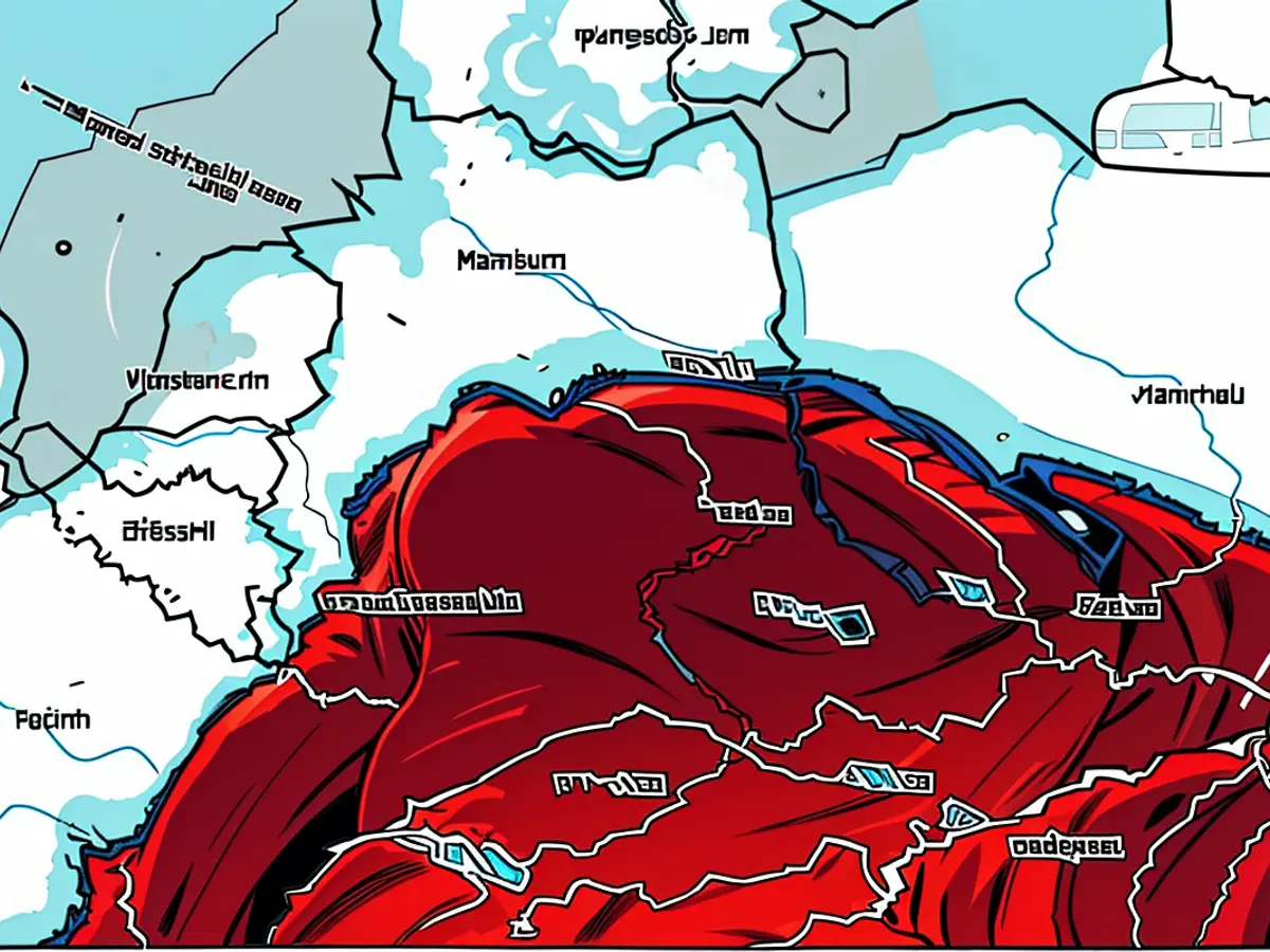
Weather Map III: DWD's thunderstorm warnings for today
The map above shows DWD's thunderstorm warnings for today. This is a binary weather map, meaning that places for which a thunderstorm warning has been issued are colored red. No coloring indicates no warning.
Weather Map IV: Anticipated maximum temperatures for today
The chart below shows the expected maximum temperatures for today. It is provided by the Wetter.de portal, which is part of RTL Germany. By clicking on the chart, you can access the provider and obtain further details.
- Despite the anticipated thunderstorms throughout most of Germany on Thursday, Northern Germany and the northeast region are expected to experience calmer weather conditions, as mentioned by the German Weather Service (DWD).
- The Alps region, like other parts of Germany, should be prepared for significant thunderstorms, as warned by DWD, which could potentially lead to heavy rainfall exceeding 30 liters per square meter.
- While DWD issues thunderstorm warnings for various regions across Germany, the German meteorological service does not provide any warnings for the northern part of the country on Weather Map III, indicating a low risk of thunderstorms in this area.


