Northern Germany - Strong winds bring heavy storm surge to the Elbe, Weser and Ems rivers
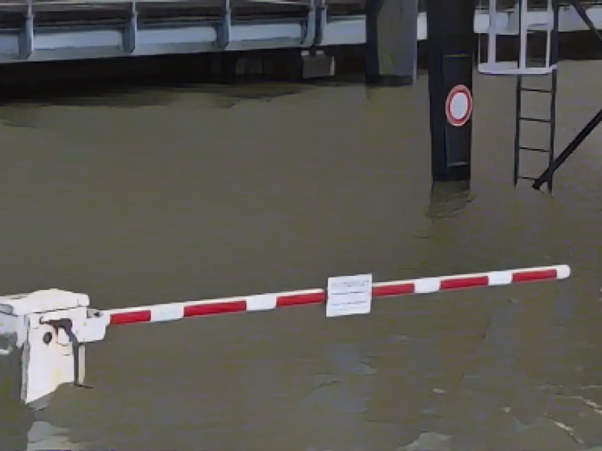
Northern Germany is set to remain stormy and wet: The Federal Maritime and Hydrographic Agency (BSH) has predicted severe storm surges for the Elbe, Weser and Ems rivers in Hamburg, Schleswig-Holstein, Lower Saxony and Bremen on Friday morning. Water levels in the rivers are expected to rise to more than 2.5 meters above mean high water between 8.00 am and 12.00 pm, as the Federal Maritime and Hydrographic Agency (BSH) announced on Thursday.
Severe storm surge applies from a water level of 2.5 meters above mean high tide. However, this is not yet an official warning of a severe storm surge, said Jennifer Brauch from the BSH forecasting services for the North Sea and Baltic Sea. This will only be issued around midnight when the storm surge expected for Thursday evening, which is already being warned of, has passed.
This storm surge expected for the North Sea coasts and rivers on Thursday evening also has the potential to rise to the level of a severe storm. "We are now seeing a tendency for a severe storm surge to occur on Thursday evening," Brauch continued. The forecast will show more details at midday. If the wind remains strong, it could become a severe storm surge.
The background to this is that the wind is currently blowing consistently strong from one direction, causing the water to build up on the North Sea coast. "Once the tidal wave has passed the North Sea islands, it will run up the rivers in its wake," said Brauch. Water levels on the North Sea coast were expected to be 1.5 to 2.0 meters above mean high tide on Thursday morning. In the Elbe and Weser regions, they should climb to 2.0 to 2.5 meters above mean high water.
At the same time, the German Weather Service (DWD) expected heavy squalls on land and gale-force winds on the coasts of the North Sea and Baltic Sea on Thursday. Accordingly, it warned of gale-force gusts with wind speeds of up to 115 kilometers per hour on the entire North Sea coast from 12:00 noon. For the Baltic Sea, the storm warning was in effect from 6 p.m., as DWD meteorologist Mareike Pohling said. Temperatures will range from 8 to 12 degrees Celsius on Thursday and drop to 5 to 7 degrees on Friday.
At the same time, it will continue to rain a lot and thunderstorms are also possible, especially around the Harz Mountains. The DWD warned of heavy continuous rain here. This is likely to continue throughout the weekend, Pohling added. In the Harz Mountains, gale-force winds and rainfall of between 60 and 90 liters per square meter are expected. According to the information, up to 120 liters can be reached in congested areas.
Severe storms are not unusual for this time of year, continued meteorologist Pohling. "It's not an everyday situation, but it's also not unusual to have a storm in winter."
Water level forecast BSH DWD forecast
Read also:
- A clan member is punished here
- Traffic lawyer warns: Don't talk to the police!
- Will he be convicted as Jutta's murderer after 37 years?
- He also wanted to kill his cousin
- The storm surge will affect various rivers in Northern Germany, including the Elbe, Weser, and Ems, which run through cities like Hamburg, Schleswig-Holstein, Lower Saxony, and Bremen.
- The BSH has issued a warning for severe storm surges on the North Sea coasts and rivers, with water levels expected to reach more than 2.5 meters above mean high water.
- The strong winds blowing from one direction are causing the water to build up on the North Sea coast, leading to the potential for severe storm surges.
- The expected storm surge on Thursday evening could reach the level of a severe storm, and the Federal Maritime and Hydrographic Agency (BSH) will issue an official warning if the wind remains strong.
- The North Sea coast and Baltic Sea are expected to experience heavy squalls and gale-force winds on Thursday, with wind speeds of up to 115 kilometers per hour on the entire North Sea coast.
- At the same time, the German Weather Service (DWD) warns of thunderstorms around the Harz Mountains, with heavy continuous rain and up to 120 liters of rainfall in congested areas.
- This storm surge and bad weather are not unusual for this time of year, according to meteorologist Pohling, but they do pose a significant threat to the North Sea and Baltic Sea coasts and rivers in Northern Germany.
- The cities of Bremen and Hamburg, located on the Elbe and Weser rivers, respectively, are also at risk of flooding due to the high water levels and storm surge.
- The Lower Saxony and North Sea coast, as well as the Ems river in Schleswig-Holstein, are also expected to be affected by the storm surge and high water levels, potentially causing damage to the infrastructure and impacting the local communities.
Source: www.stern.de


