Storm - Strong winds and storm surge: first peak during the night
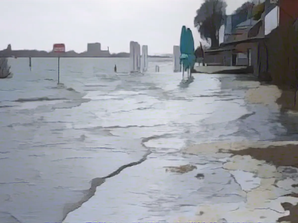
It will remain stormy and wet in northern Germany: The Federal Maritime and Hydrographic Agency (BSH) has predicted severe storm surges for the Elbe, Weser and Ems rivers in Hamburg, Schleswig-Holstein, Lower Saxony and Bremen on Friday morning. Water levels in the rivers are expected to rise to more than 2.5 meters above mean high water between 8.00 am and 12.00 pm, as the Federal Maritime and Hydrographic Agency (BSH) announced on Thursday.
Severe storm surge applies from a water level of 2.5 meters above mean high tide. However, this is not yet an official warning of a severe storm surge, said Jennifer Brauch from the BSH forecasting services for the North Sea and Baltic Sea. This will only be issued around midnight when the storm surge expected for Thursday evening, which is already being warned of, has passed.
This storm surge expected for the North Sea coasts and rivers on Thursday evening also has the potential to rise to the level of a severe storm surge. "We are now seeing a tendency for a severe storm surge to occur on Thursday evening," Brauch continued. The forecast will show more details at midday. If the wind remains strong, it could become a severe storm surge.
The background to this is that the wind is currently blowing consistently strong from one direction, causing the water to build up on the North Sea coast. "Once the tidal wave has passed the North Sea islands, it will run up the rivers in its wake," said Brauch. Water levels on the North Sea coast were expected to be 1.5 to 2.0 meters above mean high tide on Thursday morning. In the Elbe and Weser regions, they should climb to 2.0 to 2.5 meters above mean high water.
At the same time, the German Weather Service (DWD) expected heavy squalls on land and gale-force winds on the coasts of the North Sea and Baltic Sea on Thursday. Accordingly, it warned of gale-force gusts with wind speeds of up to 115 kilometers per hour on the entire North Sea coast from 12:00 noon. For the Baltic Sea, the storm warning was in effect from 6 p.m., as DWD meteorologist Mareike Pohling said. Temperatures will be between eight and twelve degrees Celsius on Thursday and drop to five to seven degrees on Friday.
At the same time, it will continue to rain a lot and thunderstorms are also possible, especially around the Harz Mountains. The DWD has warned of heavy continuous rain here. This is likely to continue throughout the weekend, Pohling added. In the Harz Mountains, some heavy squalls and rainfall of between 60 and 90 liters per square meter are expected. According to the information, up to 120 liters can be reached in congested areas.
Severe storms are not unusual for this time of year, continued meteorologist Pohling. "It's not an everyday situation, but it's also not unusual to have a storm depression in winter."
The storm had already had its first effects in the north in the afternoon. A fallen tree on the Hamburg - Kiel/Flensburg railroad line caused disruptions. Deutsche Bahn's regional services between Hamburg and Neumünster were temporarily suspended in both directions.
The operators of the Christmas markets initially kept their stalls open as planned - but kept a close eye on the situation in the afternoon. "The huts are storm-proof anyway. That is a requirement of the city. We'll wait and see how it develops today. If it gets too extreme, I will close the Christmas market," one of the operators told the German Press Agency in Hamburg.
Water level forecast BSH DWD forecast
Read also:
- A clan member is punished here
- Traffic lawyer warns: Don't talk to the police!
- Will he be convicted as Jutta's murderer after 37 years?
- He also wanted to kill his cousin
- Mareike Pohling, a meteorologist from the German Weather Service (DWD), warned of gale-force winds on the entire North Sea coast from 12:00 noon, which could reach wind speeds of up to 115 kilometers per hour.
- The BSH forecasting services, headed by Jennifer Brauch, predicted severe storm surges for the Elbe, Weser, and Ems rivers in Hamburg, Schleswig-Holstein, Lower Saxony, and Bremen on Friday morning.
- Water levels in the North Sea coast were expected to be 1.5 to 2.0 meters above mean high tide on Thursday morning, while in the Elbe and Weser regions, they should climb to 2.0 to 2.5 meters.
- Deutsche Bahn's regional services between Hamburg and Neumünster were temporarily suspended in both directions due to a fallen tree on the Hamburg - Kiel/Flensburg railroad line caused by the storm.
- The Christmas market operators in Hamburg kept their stalls open as planned but monitored the situation closely, ready to close if extreme conditions arose.
- Warnings of heavy squalls and gale-force winds were issued for the North Sea and Baltic Sea coasts, with the storm surge expected for the North Sea coasts and rivers having the potential to rise to the level of a severe storm surge.
- The storm had its first effects in northern Germany in the afternoon, causing disruptions to transportation and raising concerns about the safety of the Christmas markets.
- Many rivers in Northern Germany, such as the Elbe and Weser, which flow into the North Sea, are at risk during storm surge events, and the shipping industry in Bremen and the Ems estuary is particularly vulnerable.
- Due to the bad weather, Jennifer Needs, a resident of Schleswig-Holstein, decided to stay indoors and avoid any unnecessary travel.
- The Federal Maritime and Hydrographic Agency advised residents in the affected areas to take precautions, such as securing their properties and moving valuables to higher ground, to protect against potential flood conditions.
Source: www.stern.de


