Weather in Germany - Showers and thunderstorms: Maps show where thunderstorms are approaching
## Contents
- Weather Map I: See live where thunderstorms are forming now
- Weather Map II: Maximum temperatures for today
- Weather Map III: Real-time precipitation and 48-hour forecast
- Weather Map IV: Thunderstorm warnings for today
At the weekend, some thunderstorms swept over Germany and caused an interruption of the EM match between Germany and Denmark in Dortmund. The German Weather Service (DWD) no longer issues weather warnings at the start of the week, but the summer is still making a few more days of pause in many places.
"Unstable weather conditions continue for the time being, as stated on the DWD website on Monday morning. Furthermore, "cool, at best moderately warm air masses from the Atlantic are making their way to Germany". The result: unsettled weather conditions with heavy rain showers and thunderstorms. Initially, there will be thunderstorms in the north and in the center, and in the south there will be isolated thunderstorms, some of which may bring strong rain and gusty winds. In the north, there is also a possibility of small hail or snow pellets in the afternoon.
The following charts show the current weather situation:
Weather Map I: See live where thunderstorms are forming now
The chart below shows the current weather conditions in real-time. In addition, you can retrieve the forecast for a later time period by using the time slider at the bottom of the chart. The displayed layer can also be changed, for example, to thunderstorms, rain or snow.
Weather Map II: Maximum temperatures for today
The chart below shows the expected maximum temperatures for today.
Weather Map III: Real-time precipitation and 48-hour forecast
The chart above shows the current precipitation.
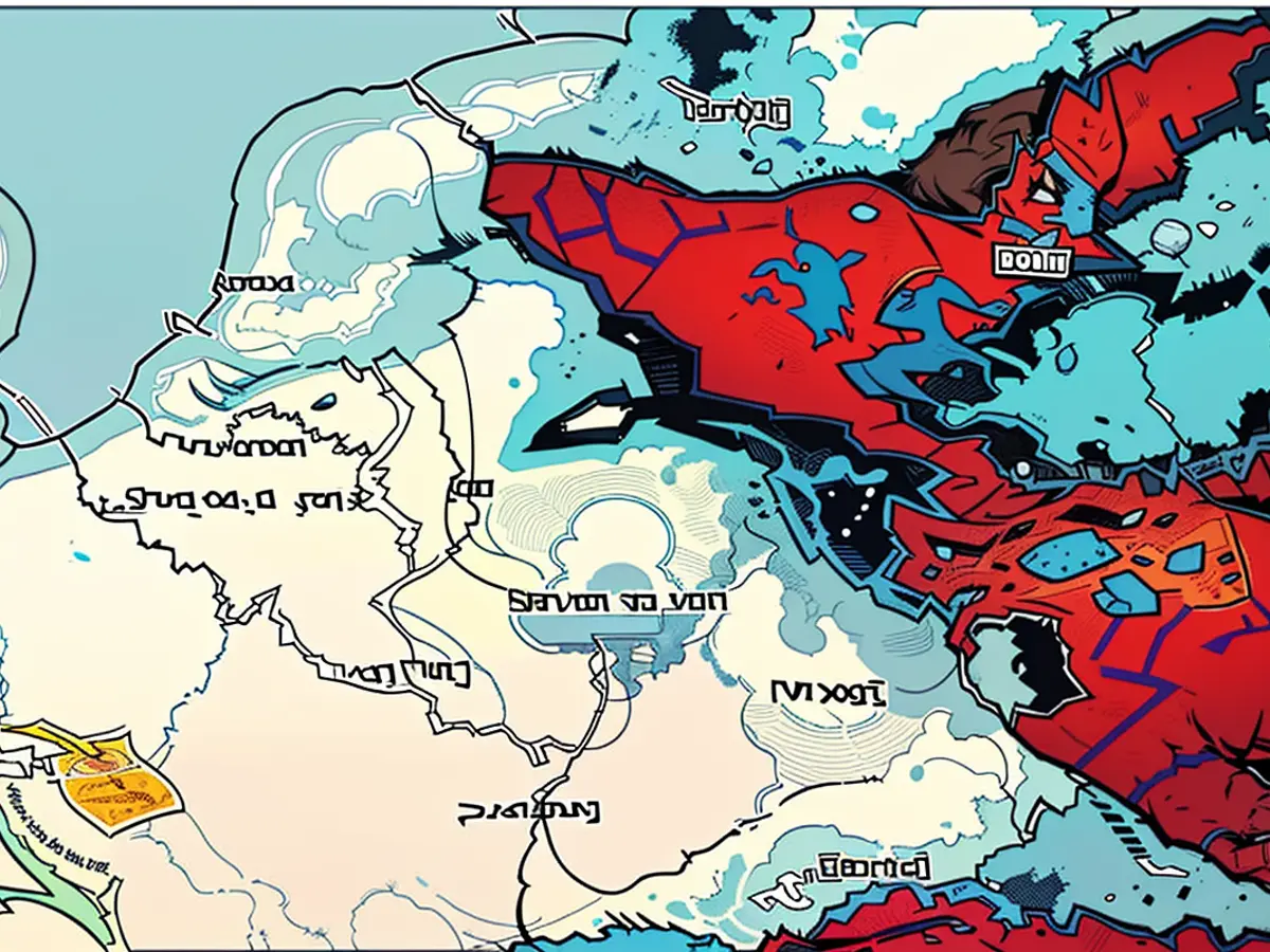
Weather Map IV: Thunderstorm warnings for today
The chart above shows the thunderstorm warnings issued by the DWD for today. This is a binary weather chart, meaning that places for which there is a thunderstorm warning are highlighted in red. No highlighting indicates no warning.
The charts used are partly from wetter.de. The portal is part of RTL Germany. In addition, charts from Windy.com have been embedded. The creators use models from the "European Centre for Medium-Range Weather Forecasts" for their representations and forecasts.
The headlines this morning in Germany are filled with news about the ongoing thunderstorms, as several regions are under thunderstorm warnings according to Weather Map IV. Despite the German Weather Service (DWD) not issuing weather warnings at the beginning of the week, the top news remains the impact of these storms, as seen in the interruption of the EM match between Germany and Denmark last weekend due to heavy thunderstorms.


