Government alerts issued - Hefty rain and storms anticipated once more - graphics display the weather circumstances
## Contents
- Live Weather Map for Storm Tracking: Check where storms are brewing
- Wind and Storm Map: Fastest gusts of the day
- Precipitation and Forecast Map: Real-time rainfall and next two days' predictions
- Today's Thunderstorm Warnings Map: DWD's yellow alerts
Summer's delay is evident in many areas of Germany, instead of making an appearance. Instead, southwest and western parts of the country will encounter stormy weather on Friday. The German Weather Service (DWD) cautioned the public on Friday morning against strong winds, even some severe gusts, in the observed regions. Throughout the night until Saturday, the warning suggests potential for heavy thunderstorms and significant rainfall across the western half. In southwestern Baden-Württemberg, the DWD has released a formal notice for heavy rainfall.
Here are the charts detailing the current climate conditions:
Live Weather Map for Storm Tracking: Check where storms are brewing
This chart shows the actual weather conditions as they happen. You can search for future weather information by using the timeline located beneath the graphic. The displayed layer can be modified to show thunderstorms, rain, or snow, among others.
Windy.com is responsible for this service and uses the "European Centre for Medium-Range Weather Forecasts" for its visualizations and predictions.
Wind and Storm Map: Fastest gusts of the day
The graph above indicates where the day's most powerful wind gusts are forecasted.
Real-time Precipitation and Forecast Map: 48-hour prediction
The graph above illustrates current rainfall conditions. To access additional information, click on the graph, which will lead you to Wetter.de, which is affiliated with RTL Germany.
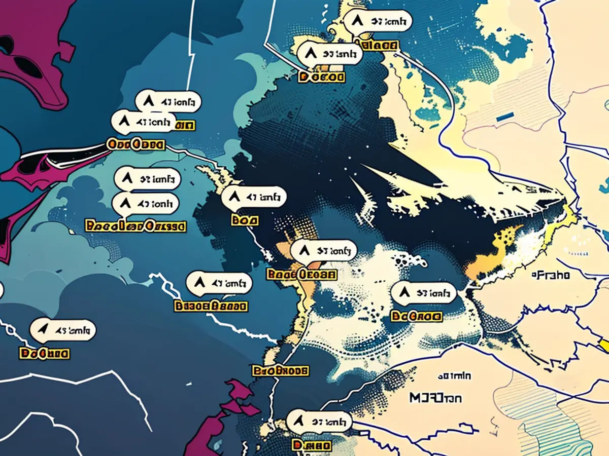
DWD's Thunderstorm Warnings for Today: Yellow Alerts
The chart above features DWD's warning for thunderstorms today. Places marked in red have a thunderstorm alert.
DWD in partnership with dpa
Read also:
- The headlines this Friday highlight the top news of heavy thunderstorms and potential significant rainfall across western Germany, prompting yellow alerts from the German Weather Service (DWD).
- Amidst the weekend forecasts, Germany's southwest and western regions should brace for a series of thunderstorms, with some parts of Baden-Württemberg facing the brunt of heavy rainfall, according to DWD's storm warnings.
- As the German news cycle churns, the top headlines include alerts for severe thunderstorms predicted to hit parts of Germany during the weekend, potentially causing disruptions and heavy rainfall, as warned by the DWD.


