Risk of floods - Flooding alert: view the present water heights on this map.
"Recently, meteorologists from the German Weather Service (DWD) have announced that the weather forecasted for several southern German regions over the past few days is now occurring south of the Danube and expanding northward," they shared on Friday. Multiple districts in southern Germany have had weather warnings issued by the DWD due to heavy rainfall, with flood risks in many locations (view the current alert report). In an area from the Black Forest to western Bavaria, rainfall totalling 50-100 liters per square meter is expected to accumulate within 72 hours until Monday night, while 150 liters of rain is anticipated in the region from Swabia northeastwards to the Danube.
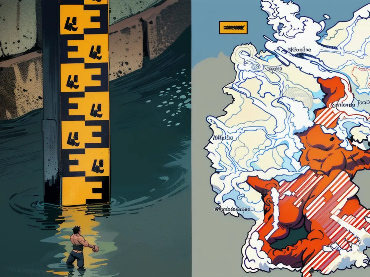
Picture: Map displays current water amounts and locations at risk for flooding
Below is a map illustrating the current water levels and the anticipated flooding locations. Regions colored red signify an official severe flooding alert, purple denotes very severe flooding, orange signifies a moderate flooding warning, and yellow dots indicate a minor flooding warning. Areas featuring dashed lines have received a warning from the responsible authorities, while green regions can drain water. Areas colored white have nowarning. North Rhine-Westphalia currently has no available data. This map is updated automatically using data from the cross-state flood portal of the federal states. Click on one of the colored dots for more details and to access the corresponding portal for flooding.
Note: You can also zoom in and adjust your view of the map.
Additional reading on the subject:
- Torrential downpours inundate homes apart from rivers. Maps show at-risk zones. How to safeguard your place - and why basements can become dangerously deadly traps.
- DWD director warns: "Intense rainfall will intensify, sweltering days will grow even hotter" (stern+)
Read also:
- Due to the storm situation, meteorologists at DWD predict that the water level in several regions of Germany, including the Black Forest and western Bavaria, may significantly increase over the next few days, potentially leading to flooding.
- The German Weather Service (DWD) has issued flood warnings for multiple districts in southern Germany, as the predicted heavy rainfall could cause water levels to exceed safe limits, leading to flooding situations.
- In response to the potential for flooding, authorities in Germany have issued warnings and closely monitored affected areas, such as those in Swabia northeastwards to the Danube, where the water level could reach up to 150 liters per square meter within 72 hours.


