Weather - Flood risk increases in northern and eastern Bavaria
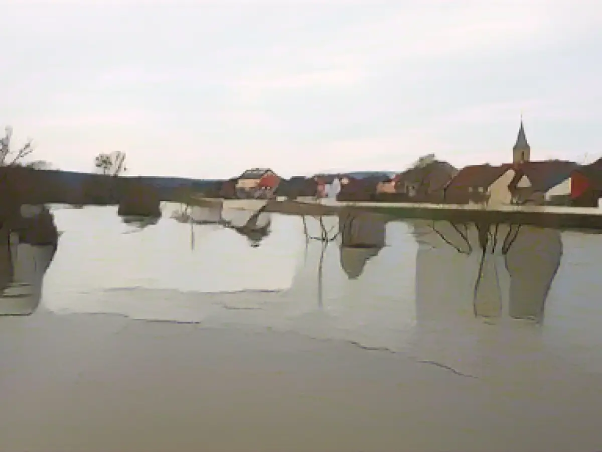
Persistent rainfall, particularly in the north and east of Bavaria, has once again increased the risk of flooding. According to the flood information service on Tuesday, large parts of Upper Franconia are affected. Flood warnings were also issued in the eastern Bavarian areas around the Naab and Regen rivers.
For the city and district of Bamberg, the responsible water management office in Kronach expected that several gauges would exceed reporting level 3 during the course of Tuesday - for example on the Itz near Schenkenau and on the Main near Kemmern and Schwürbitz. At reporting level 3, individual built-up properties, cellars and streets could be flooded. The authorities expected a similar situation on several rivers in the districts of Kronach, Forchheim, Lichtenfels and for the city and district of Coburg.
The reason is continuous rain with 50 to 60 liters per square meter within 48 hours. According to the German Weather Service (DWD), between 60 and 80 liters of rain per square meter are possible in some areas in the Rhön, Frankenwald, Fichtelgebirge and Bavarian Forest. The rainfall is expected to continue into Thursday night.
In eastern Bavaria, the flood information service of the Bavarian State Office for the Environment announced that in some places, flood level two was expected to be reached on Wednesday night. In the catchment area of the river Regen in the district of Cham, even level 3 is possible. "Large and small bodies of water may overflow. The first peak will be reached on Wednesday night and a further rise is expected over the course of the week," it said. The water levels on the Danube are also expected to rise and could reach reportable levels over the course of the week.
At the same time, the DWD is expecting snow at higher altitudes. Above 600 to 800 meters, up to three centimeters could fall, and in some cases five to ten centimeters at higher elevations in the eastern low mountain ranges. During the course of the day, the snow line is expected to rise significantly and the precipitation will partly change to rain at lower altitudes. It will remain mild with temperatures between 3 and 11 degrees.
Situation report of the HND Warning situation report of the DWD
Read also:
- A clan member is punished here
- Traffic lawyer warns: Don't talk to the police!
- Will he be convicted as Jutta's murderer after 37 years?
- He also wanted to kill his cousin
- In the district of Bamberg, the water management office in Kronach predicted that several gauges would exceed reporting level 3 due to the persistent rainfall in Bavaria.
- The flood information service mentioned that flood warnings were issued in the eastern Bavarian areas around the Naab and Regen rivers, specifically affecting the northern and eastern parts of the state.
- The city and district of Bamberg could see individual built-up properties, cellars, and streets flooded at reporting level 3, with similar situations expected on several rivers in neighboring districts such as Kronach, Forchheim, Lichtenfels, and Coburg.
- Eastern Bavaria anticipates reaching flood level 2 in some places by Wednesday night and possibly even level 3 in the catchment area of the river Regen in the district of Cham, according to the flood information service of the Bavarian State Office for the Environment.
- The German Weather Service (DWD) predicts up to 80 liters of rain per square meter in the Rhön, Frankenwald, Fichtelgebirge, and Bavarian Forest, which could potentially result in increased flood risks in these areas.
- Additionally, the DWD is expecting snowfall in eastern Bavaria at altitudes above 600 to 800 meters and up to 10 centimeters in the higher elevations of the eastern low mountain ranges during the course of the day.
- Flood information services are vital in providing accurate updates on flood risks, helping individuals and authorities in affected areas to take appropriate safety measures and respond to potential flooding.
Source: www.stern.de


