East Coast experiences heavy rainfall on Memorial Day while excessive heat torments the South.
Intense storms and suspected twisters caused at least 18 deaths, including four kids, as extreme weather swept through Arkansas, Texas, and Oklahoma on Saturday night into Sunday.
Pictures of the aftermath depicted piles of rubble, wrecked autos, and destroyed buildings. Severe winds and rain took down trees and electrical cables, leaving over half a million people without electricity across 12 states. The storms also delayed the 108th Indianapolis 500 by around four hours on Sunday afternoon.
Ferocious weather persisted in parts of Kentucky overnight, resulting in damage to some communities. Governor Andy Beshear declared a state of emergency on Monday as a result.
Luckily, respite is on the horizon as the storm system shifts eastward on Monday, and its more intense and hazardous effects are predicted to diminish.
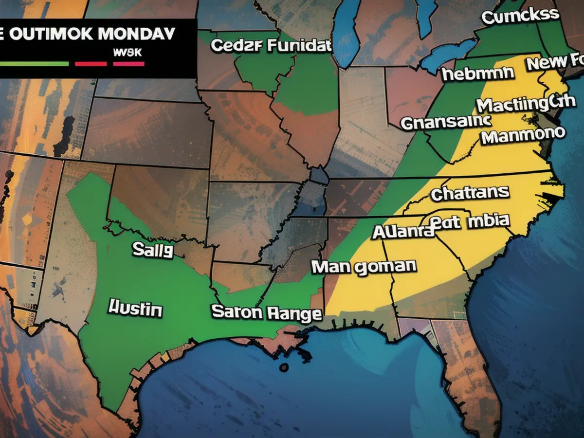
On Monday, heavy rain will inundate the East Coast. While the risk of tornadoes is much lower than what occurred over the weekend, there is still a slim chance of isolated tornadoes in Newark, New Jersey, and the Carolinas.
Major East Coast cities also contend with dangerous winds. Meanwhile, scorching temperatures threaten the start of the unofficial summer in the South, with possible record-breaking highs.
The storm front is expected to arrive on the Eastern Seaboard by Tuesday evening, according to the National Weather Service's Storm Prediction Center.
"The boundary will create an area of showers and severe thunderstorms over parts of eastern Missouri and the Ohio Valley," the center stated.
There is a level 3 out of 5 risk of severe thunderstorms for these areas as well as the Tennessee Valley from Monday morning through Monday evening. This region faces potential risks such as frequent lightning, forceful thunderstorm winds, hail, and a few tornadoes.
"There will be an added threat of EF2 to EF5 tornadoes and hail 2 inches or greater over parts of the Lower Mississippi/Western Tennessee Valleys," the Storm Prediction Center added.
Areas within the Upper Mississippi Valley and Upper Great Lakes, including sections of Wisconsin, are also at risk of localized flash flooding due to intense rain through Monday morning.
Rainstorms pose a threat to Memorial Day plans in the Mid-Atlantic and Northeast. There is a level 2 out of 4 slight risk of excessive rainfall in these areas from Monday to Tuesday morning, with flash flooding in low-lying and urban zones feasible.
Scorching temperatures to scorch the Southern region
High temperatures and an early-season heatwave are projected to make for a grueling Memorial Day weekend in various regions of the U.S. South, including southern Texas, the central Gulf Coast, and southern Florida.
South Texas is under an extreme heat warning through Monday evening, and more heat warnings and advisories are expected to be issued in the South.
Houston, New Orleans, Miami, Mobile, Alabama, Tampa, Florida, and Charleston, South Carolina, are among the areas that may experience record-breaking heat on Monday.
Temperatures in these areas will be near record-highs, with heat index readings potentially surpassing 115 degrees. The heat index – which measures how hot it feels to the human body – is expected to reach around 110 degrees in Houston and 119 degrees in Laredo, according to the local National Weather Service office.
Evening reprieve may be scarce in certain spots. Overnight low temperatures are anticipated to be 10 to 15 degrees above the norm.
Such intense, sustained warmth elevates the risk of heat-related illnesses, such as heat stroke, primarily in susceptible populations: children, adults with underlying health conditions, pregnant women, and outdoor workers.
The perils of extreme heat – the deadliest form of extreme weather – are becoming more prevalent due to human-caused climate change and its impact on warming temperatures.

Read also:
- Rain expected again: The situation in the flood areas remains threatening
- Continuous rain until Thursday: Concerns about collapsing dykes are growing in the flood areas
- Flood situation remains tense - more rain forecast
- Flood situation remains tense - weir on the Elbe is opened
While the East Coast prepares for heavy rain on Monday, the risk of isolated tornadoes remains in Newark, New Jersey, and the Carolinas.
Despite the shifting storm system, scorching temperatures persist in the South, threatening to break record highs in various regions.
Source: edition.cnn.com


