Table of Contents
- Live Weather Tracker: Monitor areas with intense weather development
- Temperature Chart: Today's highest temperature readings
- Wind and Storm Chart: Today's maximum wind speeds
- Thunderstorm Alerts: Today's potential severe weather zones
- Tomorrow's Thunderstorm Alerts: Potential intensifying weather areas for tomorrow
- End of summer anticipation: scorching temperatures, thunderstorms, and substantial rainfall predicted
Summer's final push is nearly here: According to meteorologists, on Tuesday, most of Germany should experience sweltering temperatures, complete with all the usual side effects. The German Weather Service (DWD) predicts showers and occasional thunderstorms in the North Sea region until morning. There's a chance of intense rainfall, up to 20 liters per square meter per hour, in some places. More severe weather with rainfall exceeding 25 liters per square meter is not out of the question.
"From midday onwards, except for the far west and northeast, individual thunderstorms will occur again, particularly in the center and south, starting from the midlands or late afternoon, and even from the Alps in the evening. Intense rainfall of up to 20 liters per square meter in a short time, small hail, and winds of up to 70 km/h (Bft 7 to 8)" is what the DWD forecasts on their website.
There's still a possibility of severe weather due to intense rainfall exceeding 30 liters per square meter in a short period. In some rare instances, extreme conditions with rainfall amounts between 40 and 60 liters per square meter in 1 to 2 hours cannot be ruled out.
More severe weather expected on Wednesday
On Wednesday, it will be sunny and dry in the east and far southeast. In the west, there will be thunderstorms with heavy rain that will move into the north by the afternoon. The eastern middle and the Alps will see strong thunderstorms from the afternoon onwards, increasing the risk of severe weather due to heavy rain and hail. In the west, temperatures will range from 20 to 26 degrees, while in the east, they will range from 27 to 34 degrees, with the hottest spots from Uckermark to East Saxony.
The following maps display the current weather situation:
Live Weather Tracker: Monitor areas with intense weather development
The interactive map below provides real-time weather data. Additionally, you can also view the forecast for a later time using the timeline below the graph. The displayed layer can be changed, such as to thunderstorms, rain, or snow, by clicking the top right corner.
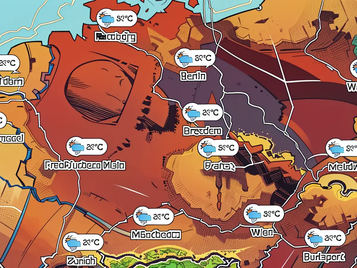
Temperature Chart: Today's highest temperature readings
The chart below shows the expected highest temperatures for today.
Wind and Storm Chart: Today's maximum wind speeds
The map above displays the areas with the strongest wind gusts of the day.
Thunderstorm Alerts: Today's potential severe weather zones
The map above shows the thunderstorm alerts issued by the DWD for today. Areas with a thunderstorm alert are colored red, while no color indicates no warning.
Tomorrow's Thunderstorm Alerts: Potential intensifying weather areas for tomorrow
The map above shows the thunderstorm alerts issued by the DWD for tomorrow. Areas with a thunderstorm alert are colored red, while no color indicates no warning.
The maps used here are partly from wetter.de. wetter.de is a part of RTL Germany, along with stern. Additionally, maps from Windy.com have been embedded. The creators use the model from the "European Centre for Medium-Range Weather Forecasts" for their displays and forecasts.
Source: DWD
The Top news today includes the prediction of severe weather conditions across Germany, with potential for intense rainfall exceeding 30 liters per square meter in some areas. Keep an eye on the Thunderstorm Alerts for today and tomorrow to stay updated on potential severe weather zones.


